
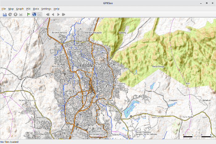
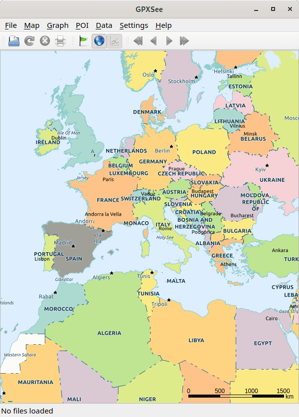
GPXSee is a Qt-based GPS log file viewer and analyzer that supports all common GPS log file formats.
The software is released under an open source license.
GPXSee supports a wide range of formats.
Key Features
- Opens GPX, TCX, FIT, KML, IGC, NMEA, SLF, LOC, GeoJSON, OziExplorer (PLT, RTE, WPT), Garmin CSV and geotagged JPEG files.
- User-definable online maps (OpenStreetMap/Google tiles, WMTS, WMS, TMS, QuadTiles).
- Offline maps (OziExplorer maps, TrekBuddy maps/atlases, Garmin IMG & JNX maps, TwoNav RMaps, GeoTIFF images, MBTiles).
- Elevation, speed, heart rate, cadence, power, temperature and gear ratio/shifts graphs.
- Support for DEM files (SRTM HGT).
- Data from the following sensors is supported by GPXSee:
- Heart rate.
- Cadence.
- Power.
- Temperature.
- Gear ratio/shifts (Shimano Di2, SRAM eTap).
- Support for POI files.
- Print/export to PDF. There are 2 print modes:
- WYSIWYG – the printed area is approximately the display area. The map zoom level doesn’t change.
- High-Resolution – the zoom level changes so the whole content (tracks/waypoints) fits into the printed area, and the map resolution is as close as possible to the print resolution.
- Multiple tracks in one view.
- Full screen mode.
- HiDPI/Retina displays & maps support.
- OpenGL support.
- Cross-platform support – runs under Linux, Mac OS X, and Windows.
- Internationalization support.
Website: gpxsee.org
Support: Documentation, GitHub Code Repository, GPXSee Maps GitHub Code Repository
Developer: Martin Tůma and contributors
License: GNU General Public License v3.0
GPXSee is written in C++. Learn C++ with our recommended free books and free tutorials.
Related Software
| GPS Tools | |
|---|---|
| MOBAC | Create offline atlases for GPS handhelds and cell phone applications |
| GPXSee | GPS log file viewer and analyzer |
| Traccar | GPS Tracking Platform |
| gpsd | GPS service daemon |
| Viking | GPS data editor, analyzer and viewer |
| GPSBabel | GPS file conversion plus transfer to/from GPS units |
| GpsPrune | View, edit, and convert coordinate data from GPS systems |
| ZombieTrackerGPS | Fitness and GPS track manager designed for KDE |
| QMapShack | GPS mapping (GeoTiff and vector) and GPSr management |
| Navit | Car navigation system with routing engine |
| GPS Correlate | Correlates digital images with GPS data filling EXIF fields |
| Open Cache Manager | Easy to use program for managing your geocaches |
| Satellite | Displays GNSS information obtained from NMEA sources |
| OpenCPN | Ship-borne GUI navigation |
| Geotagging | Photography geotagging tool |
| FoxtrotGPS | GPS/GIS application designed for small screens |
| AAT Activity Tracker | Tracking sportive activities, with an emphasis on cycling |
Read our verdict in the software roundup.
 Explore our carefully curated directory of recommended free and open source software, covering every major software category. Explore our carefully curated directory of recommended free and open source software, covering every major software category.The directory forms part of our extensive collection of articles for Linux enthusiasts. It includes hundreds of detailed reviews, together with free and open source alternatives to proprietary software from companies such as Google, Microsoft, Apple, Adobe, IBM, Cisco, Oracle, and Autodesk. LinuxLinks also covers interesting projects worth exploring, Linux-compatible hardware, free programming books and tutorials, and much more. Know a useful free and open source Linux application that we haven’t covered? Tell us about it using our submission form. |
Please read our Comment Policy before commenting.