
Viking aims to be an easy to use, yet powerful in accomplishing, a wide variety of GPS related tasks. It uses a hierarchical layering system to organize GPS data, maps, and other layer types with spatial data, such as coordinate lines.
With this software, users can import, plot and create tracks and waypoints, show OSM, Terraserver and other maps, see real-time GPS position, get geocaches, control items, etc.
It uses the GTK+ 3 toolkit.
Key Features
- Uploading and downloading waypoints, tracks to/from GPS.
- Realtime GPS tracking and track recording.
- Preparing tracks and waypoints for trips using maps from services such as Googlemaps, Terrasever. You only need to upload the data to your GPS before you leave. The maps together with your tracks and waypoints can also be printed and used during the trip.
- After trips, tracks and waypoints from GPS can be downloaded, stored, managed and reused in later trips.
- Analyzing OHV and hiking trips, understanding where you went and how far you were from something.
- Making waypoints and tracks to follow to easily get some place you have not been to or do not have GPS data for but Terraserver maps exist for it.
- Making maps with coordinate lines.
- Analyzing speed at different places, adding waypoints where you forgot to mark one but did slow down or stop.
- Grouping data from multiple trips using a hierarchical data manager.
- Show the live GPS position on the map (for use on a mobile device – e.g. a laptop).
- Layers supported:
- Aggregate – a container layer to hold other layers. This layer type is useful for grouping other layers, especially TrackWaypoint layers.
- TrackWaypoint – displays GPS data (tracks and waypoints).
- GPS – responsible for uploading and downloading GPS data from a GPS device. It also is responsible for realtime GPS tracking.
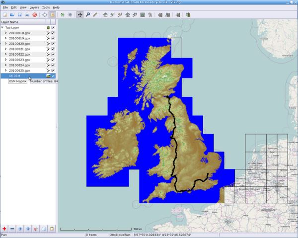
- DEM – provides elevation data from the Shuttle Radar Topography Mission (SRTM).
- Coord – allows drawing of grid lines on the viewport.
- GeoRef – allows users to use any image as a map.
- Maps – provides a single map resource, you may have multiple map layers but only top one (if enabled) will be visible. Inbuilt maps include:
- Terraserver Topos.
- Terraserver Aerials.
- Terraserver Urban Areas.
- OpenStreetMap (Osmarender).
- OpenStreetMap (Mapnik).
- OpenStreetMap (Maplint).
- OpenStreetMap (Cycle).
- NASA BlueMarble.
- SpotMap (Viking Version1.1+).
- Supports a wide variety of map types including WMS, OSM, TMS, SPOTMaps.
- Support for Locosys and DeLorme GPS devices.
- Internationalization support.
Website: sourceforge.net/projects/viking
Support: GitHub Code Repository
Developer: Evan Battaglia and contributors
License: GNU General Public License v2.0
Viking is written in C. Learn C with our recommended free books and free tutorials.
Related Software
| GPS Tools | |
|---|---|
| MOBAC | Create offline atlases for GPS handhelds and cell phone applications |
| GPXSee | GPS log file viewer and analyzer |
| Traccar | GPS Tracking Platform |
| gpsd | GPS service daemon |
| Viking | GPS data editor, analyzer and viewer |
| GPSBabel | GPS file conversion plus transfer to/from GPS units |
| GpsPrune | View, edit, and convert coordinate data from GPS systems |
| ZombieTrackerGPS | Fitness and GPS track manager designed for KDE |
| QMapShack | GPS mapping (GeoTiff and vector) and GPSr management |
| Navit | Car navigation system with routing engine |
| GPS Correlate | Correlates digital images with GPS data filling EXIF fields |
| Open Cache Manager | Easy to use program for managing your geocaches |
| Satellite | Displays GNSS information obtained from NMEA sources |
| OpenCPN | Ship-borne GUI navigation |
| Geotagging | Photography geotagging tool |
| FoxtrotGPS | GPS/GIS application designed for small screens |
| AAT Activity Tracker | Tracking sportive activities, with an emphasis on cycling |
Read our verdict in the software roundup.
 Explore our comprehensive directory of recommended free and open source software. Our carefully curated collection spans every major software category. Explore our comprehensive directory of recommended free and open source software. Our carefully curated collection spans every major software category.This directory is part of our ongoing series of informative articles for Linux enthusiasts. It features hundreds of detailed reviews, along with open source alternatives to proprietary solutions from major corporations such as Google, Microsoft, Apple, Adobe, IBM, Cisco, Oracle, and Autodesk. You’ll also find interesting projects to try, hardware coverage, free programming books and tutorials, and much more. Discovered a useful open source Linux program that we haven’t covered yet? Let us know by completing this form. |
Please read our Comment Policy before commenting.
Does this work on Raspberry Pi 3 Buster?, I tried the “Snap” version, no Icon, so I cannot activate it,