
Open Cache Manager (OCM) is an easy to use, open source program for managing your geocaches, with the goal of being the Linux equivalent to GSAK.
OCM integrates with GPSBabel to support most GPS devices.
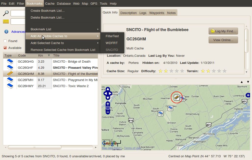
This software allows you to organize and store geocaching information in one or more databases. You can use filters to search databases, create bookmark lists of caches, keep notes on caches, and store additional waypoints.
Key Features
- Attractive Gnome graphical user interface.
- Multiple Databases.
- Advanced filtering.
- GPX Import/Export, LOC File Import.
- Waypoint Management.
- Grab waypoints from cache description.
- View Selected Cache and Nearby Caches in Map View.
- GPSBabel Integration (requires GPSBabel to be installed).
- Create Bookmark Lists to Organize your Geocaching Database.
- Add Notes to Caches.
- Supports Geocaching.com, Terracaching.com and Navicache.com.
- Combination filters.
- GPS profiles.
- Multiple saved locations.
- Offline logging.
- Bookmark lists.
- Corrected coordinates.
- Field notes support for paperless devices (Garmin and Delorme).
- Import ZIP files directly.
- English, Dutch, Danish, German, Swedish, and Czech translations.
There is also a mobile edition for smartphones and tablet devices, providing access to your OCM databases on the go.
Website: opencachemanage.sourceforge.net
Support: SourceForge Project Page
Developer: OCM Team
License: Apache License v2.0
OCM is written in C#. Learn C# with our recommended free books and free tutorials.
Related Software
| GPS Tools | |
|---|---|
| MOBAC | Create offline atlases for GPS handhelds and cell phone applications |
| GPXSee | GPS log file viewer and analyzer |
| Traccar | GPS Tracking Platform |
| gpsd | GPS service daemon |
| Viking | GPS data editor, analyzer and viewer |
| GPSBabel | GPS file conversion plus transfer to/from GPS units |
| GpsPrune | View, edit, and convert coordinate data from GPS systems |
| ZombieTrackerGPS | Fitness and GPS track manager designed for KDE |
| QMapShack | GPS mapping (GeoTiff and vector) and GPSr management |
| Navit | Car navigation system with routing engine |
| GPS Correlate | Correlates digital images with GPS data filling EXIF fields |
| Open Cache Manager | Easy to use program for managing your geocaches |
| Satellite | Displays GNSS information obtained from NMEA sources |
| OpenCPN | Ship-borne GUI navigation |
| Geotagging | Photography geotagging tool |
| FoxtrotGPS | GPS/GIS application designed for small screens |
| AAT Activity Tracker | Tracking sportive activities, with an emphasis on cycling |
Read our verdict in the software roundup.
 Explore our comprehensive directory of recommended free and open source software. Our carefully curated collection spans every major software category. Explore our comprehensive directory of recommended free and open source software. Our carefully curated collection spans every major software category.This directory is part of our ongoing series of informative articles for Linux enthusiasts. It features hundreds of detailed reviews, along with open source alternatives to proprietary solutions from major corporations such as Google, Microsoft, Apple, Adobe, IBM, Cisco, Oracle, and Autodesk. You’ll also find interesting projects to try, hardware coverage, free programming books and tutorials, and much more. Discovered a useful open source Linux program that we haven’t covered yet? Let us know by completing this form. |
Please read our Comment Policy before commenting.