

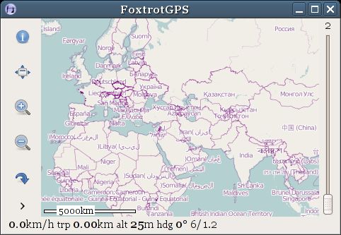
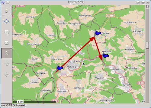
FoxtrotGPS is an open source GTK+ based mapping and GPS application. It’s typically used to show a moving map showing your position in real time. It’s useful as a navigation tool, and as a track logging (e.g. for OpenStreetMap) and trip planning tool.
FoxtrotGPS also allows internet-connected users to share their position with other users and send messages.
By default, FoxtrotGPS uses maps from OpenStreetMap, but may use a range of other maps, some in experimental mode.
FoxtrotGPS is a community developed fork from tangoGPS.
Prepackaged releases of FoxtrotGPS are available for Debian, Ubuntu, Fedora, Gentoo, AUR, NetBSD, and FreeBSD.
Key Features
- Hardware support is provided by gpsd – a GPS service daemon. Supports both the new and old gpsd protocols transparently. gpsd is a service daemon that monitors one or more GPSes or AIS receivers attached to a host computer through serial or USB ports, making all data on the location/course/velocity of the sensors available to be queried on TCP port 2947 of the host computer.
- Geotag photographs that were taken while logging a GPS track.
- Routing – plan a route in a few ways. First, there is route finding, which finds a route from point A to point B. This is done by using an online web service, which knows how to get from A to B. Second, there is route planning, which allows you to plan a route through a number of points. This route is then transferred to a separate navigation system (e.g. in a car) to guide you through the points.
- Keyboard shortcuts.
- Illustrated user manual, including a detailed introduction, and HOWTO guides on route-planning, track-logging, and tilecache-management.
- Various scripts are bundled to convert formats e.g. converting the native track-log format to OpenStreetMap format.
- Internationalization support: Czech, Dutch, Finnish, French, German, Hungarian, Italian, Japanese, Polish, Portuguese, Russian, Serbian, and Spanish.
Website: www.foxtrotgps.org
Support: Documentation, Mailing List, Launchpad
Developer: Joshua Judson Rosen, Paul Wise
License: GNU General Public License v2.0
FoxtrotGPS is written in C. Learn C with our recommended free books and free tutorials.
Related Software
| GPS Tools | |
|---|---|
| MOBAC | Create offline atlases for GPS handhelds and cell phone applications |
| GPXSee | GPS log file viewer and analyzer |
| Traccar | GPS Tracking Platform |
| gpsd | GPS service daemon |
| Viking | GPS data editor, analyzer and viewer |
| GPSBabel | GPS file conversion plus transfer to/from GPS units |
| GpsPrune | View, edit, and convert coordinate data from GPS systems |
| ZombieTrackerGPS | Fitness and GPS track manager designed for KDE |
| QMapShack | GPS mapping (GeoTiff and vector) and GPSr management |
| Navit | Car navigation system with routing engine |
| GPS Correlate | Correlates digital images with GPS data filling EXIF fields |
| Satellite | Displays GNSS information obtained from NMEA sources |
| PyGPSClient | Graphical tool for GNSS receiver testing, diagnostics and configuration |
| OpenCPN | Ship-borne GUI navigation |
| gpx.studio | GPX editor for creating, modifying and planning GPS routes |
| Geotagging | Photography geotagging tool |
| AAT Activity Tracker | Tracking sportive activities, with an emphasis on cycling |
Read our verdict in the software roundup.
 Explore our carefully curated directory of recommended free and open source software, covering every major software category. Explore our carefully curated directory of recommended free and open source software, covering every major software category.The directory forms part of our extensive collection of articles for Linux enthusiasts. It includes hundreds of detailed reviews, together with free and open source alternatives to proprietary software from companies such as Google, Microsoft, Apple, Adobe, IBM, Cisco, Oracle, and Autodesk. LinuxLinks also covers interesting projects worth exploring, Linux-compatible hardware, free programming books and tutorials, and much more. Know a useful free and open source Linux application that we haven’t covered? Tell us about it using our submission form. |
Please read our Comment Policy before commenting.