

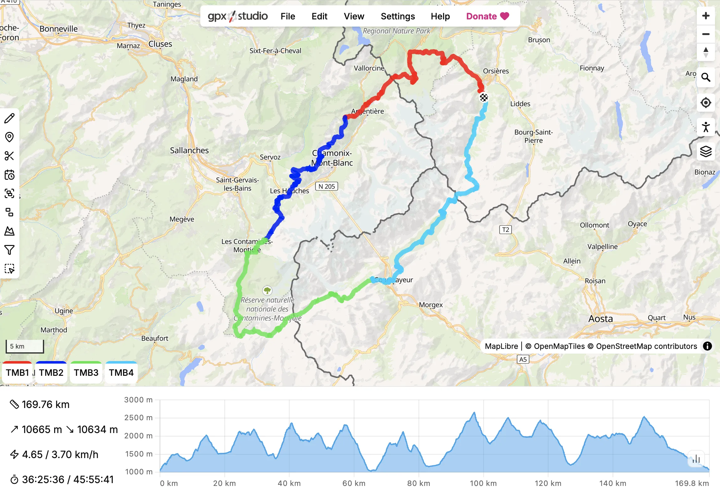
gpx.studio is a web-based GPX file editor for creating, viewing and modifying GPS tracks and routes in a browser. Its interface combines an interactive map, file tree, statistics and editing tools so multiple GPX files and their contents can be manipulated within the same workspace.
The software is particularly useful for planning routes before an outdoor activity, tidying recorded tracks afterwards, combining sections from different files and preparing GPX data for other mapping or navigation applications. Route creation is not limited to manually drawing straight lines: the application can use a routing engine to follow suitable paths and roads according to the selected activity. The project consists of a TypeScript GPX processing library and a SvelteKit web application and can also be self-hosted.
This is free and open source software.
Key Features
- Create GPX files, tracks, track segments and points of interest.
- Plan routes for cycling, road cycling, gravel cycling, mountain biking, running, hiking, motorcycling, water activities and railways.
- Route between anchor points using the road and path network or straight lines.
- Reverse routes or create routes returning to their starting point.
- Crop and split existing GPS traces.
- Connect multiple traces into a continuous trace.
- Merge file contents while retaining separate traces.
- Remove time gaps when joining traces.
- Extract multiple traces into separate items.
- Create or update realistic time information for tracks.
- Request replacement elevation data for selected files.
- Reduce the number of GPS points in a trace.
- Remove GPS points and points of interest inside or outside a selected map area.
- Display elevation profiles and switch between multiple map layers.
- Add custom WMS, WMTS and MapLibre map layers.
- Supports 3D map viewing and custom track appearance.
Website: github.com/gpxstudio/gpx.studio
Support:
Developer: gpx.studio
License: MIT License
gpx.studio is written in TypeScript. Learn TypeScript with our recommended free books and free tutorials.
Related Software
| GPS Tools | |
|---|---|
| MOBAC | Create offline atlases for GPS handhelds and cell phone applications |
| GPXSee | GPS log file viewer and analyzer |
| Traccar | GPS Tracking Platform |
| gpsd | GPS service daemon |
| Viking | GPS data editor, analyzer and viewer |
| GPSBabel | GPS file conversion plus transfer to/from GPS units |
| GpsPrune | View, edit, and convert coordinate data from GPS systems |
| ZombieTrackerGPS | Fitness and GPS track manager designed for KDE |
| QMapShack | GPS mapping (GeoTiff and vector) and GPSr management |
| Navit | Car navigation system with routing engine |
| GPS Correlate | Correlates digital images with GPS data filling EXIF fields |
| Satellite | Displays GNSS information obtained from NMEA sources |
| PyGPSClient | Graphical tool for GNSS receiver testing, diagnostics and configuration |
| OpenCPN | Ship-borne GUI navigation |
| gpx.studio | GPX editor for creating, modifying and planning GPS routes |
| Geotagging | Photography geotagging tool |
| AAT Activity Tracker | Tracking sportive activities, with an emphasis on cycling |
Read our verdict in the software roundup.
 LinuxLinks helps you discover the best free and open source software for Linux. Explore our extensive collection of recommended applications, including alternatives to popular proprietary software. We also publish software reviews, Linux tutorials, hardware reviews, free programming books and articles covering the wider open source community. Browse our Linux resources to discover more. Know a useful free and open source Linux application we haven't covered? Suggest a program for inclusion. Has your software been featured on LinuxLinks? Display one of our Featured on LinuxLinks badges on your website or GitHub README. |
Please read our Comment Policy before commenting.