

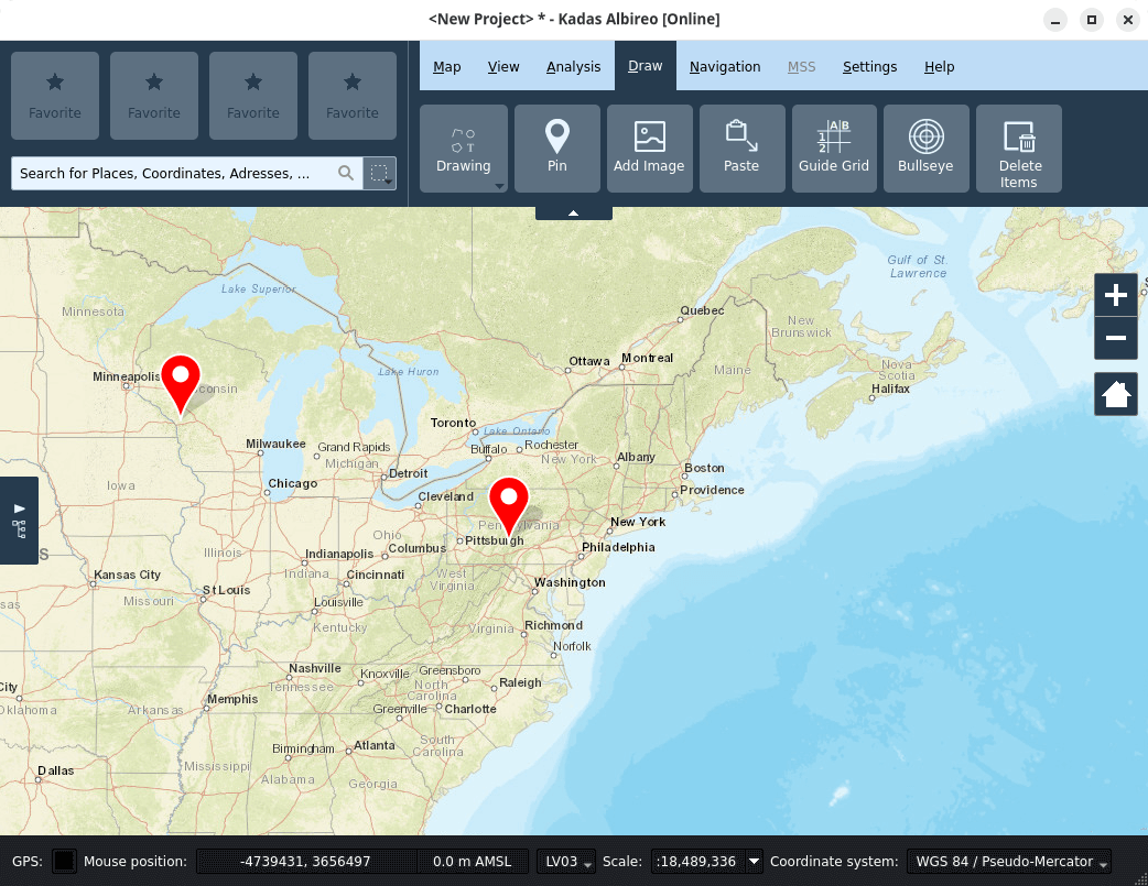
Kadas Albireo is a mapping application based on QGIS and targeted at non-specialized users, providing enhanced functionalities in areas such as drawing, measuring, terrain analysis, etc.
This is free and open source software.
Key Features
- Streamlined user interface.
- Redlining functionality for adding geometries, pins, georeferenced pictures and other symbols.
- Measurement tools, incl. geodetic measurements.
- Terrain analysis: slope, hillshade, viewshed, line of sight.
- Numeric inputs for all drawing operations.
- Integrated GPS geolocation support and GPX waypoint and route editor.
- Multiple map views.
- 3D globe view.
- Advanced map grids, including UTM/MGRS and guide grids.
- Tightly integrated search functionality.
- Integrated geodata catalog.
- Online-/Offline detection with online-/offline project templates.
- User friendly printing.
- KML and GPKG data export and import.
- Support for the MSS-MilX Military-Symbols library from gs-soft.
Website: github.com/kadas-albireo/kadas-albireo2
Support:
Developer: Sandro Mani
License: GNU General Public License v2.0
Kadas Albireo is written in C++. Learn C++ with our recommended free books and free tutorials.
Related Software
| Mapping Tools | |
|---|---|
| Organic Maps | Offline maps & GPS app for hiking, cycling, biking, and driving |
| CoMaps | Community-led maps and navigation application |
| QGIS | GIS that supports vector, raster, and database formats |
| Marble | Virtual globe and world atlas |
| Placemark | Web-based tool for geospatial data |
| Maputnik | Visual editor for creating and editing MapLibre map styles |
| JOSM | Extensible editor for OpenStreetMap |
| uMap | Web application for creating and publishing custom interactive maps |
| Map | Wardley map editor |
| Kadas Albireo | Mapping application based on QGIS targeted at non-specialized users |
| TuiView | Lightweight raster GIS |
| Pure Maps | Native map and navigation application |
| Merkaartor | OpenStreetMap mapping program |
| GNOME Maps | Find places around the world |
| FacilMap | Collaborative map for planning and sharing locations |
| VersaTiles | Generate, process, store, serve, and render map tiles |
| osmin | GPS navigator for on-road and off-road navigation |
| OpenStreetBrowser | Browse and explore OpenStreetMap data by category |
| Maps | Lightweight map viewer for exploring places and locations |
Read our verdict in the software roundup.
 Explore our carefully curated directory of recommended free and open source software, covering every major software category. The directory forms part of our extensive collection of articles for Linux enthusiasts. It includes hundreds of detailed reviews, together with free and open source alternatives to proprietary software from companies such as Google, Microsoft, Apple, Adobe, IBM, Cisco, Oracle, and Autodesk. LinuxLinks also covers interesting projects worth exploring, Linux-compatible hardware, free programming books and tutorials, and much more. Know a useful free and open source Linux application that we haven’t covered? Tell us about it using our submission form. |
Please read our Comment Policy before commenting.