

CoMaps is a community-led maps and navigation application built around OpenStreetMap data. It focuses on offline use, privacy and community governance, with downloadable maps intended for driving, cycling, walking and outdoor navigation.
The project is derived from Organic Maps and Maps.Me, but follows its own development path. Maps remain usable without an active internet connection, and map data can be updated independently from the application itself so users can receive fresher geographic information without waiting for a full software update.
This is free and open source software.
Key Features
- Provides downloadable OpenStreetMap-based maps for offline browsing, search and navigation.
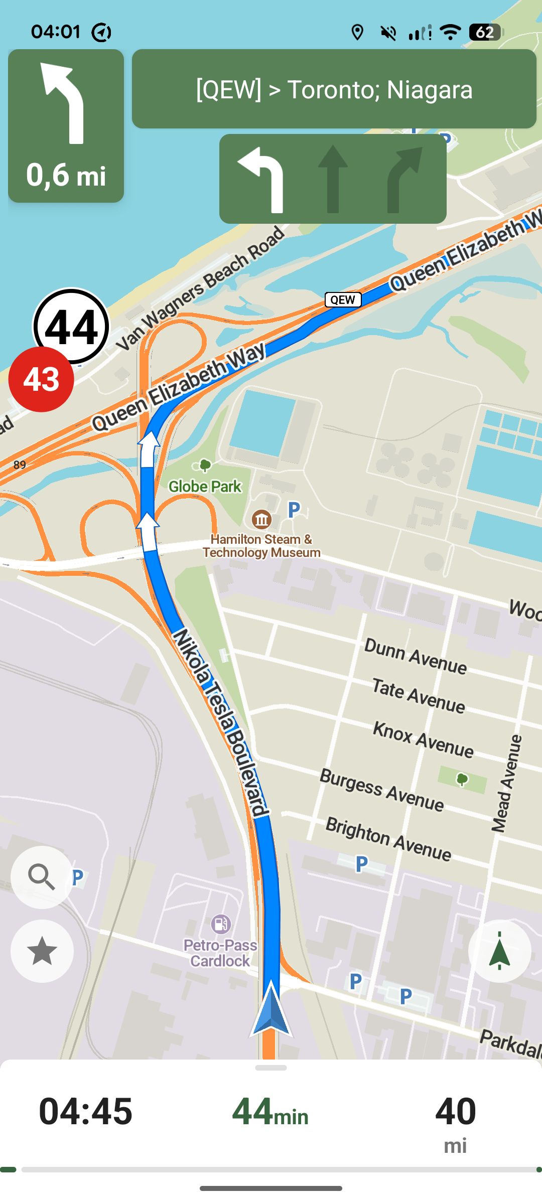
- Offers route planning and voice-guided navigation for driving, walking and cycling.
- Provides turn-by-turn route previews while planning a journey before navigation starts.
- Includes improved navigation guidance for roundabouts, U-turns, highway exits and road shields.
- Supports lane guidance on supported platforms and keeps routing options separate for different transport modes.
- Searches offline by name, address and point-of-interest category.
- Shows hiking trails, cycleways, campsites, water sources, peaks, contour lines and other outdoor-oriented details.
- Includes public transport and subway information where that data is present in OpenStreetMap.
- Supports favourites, including searching and sorting saved places.
- Records tracks and imports or exports bookmarks and tracks in KML, KMZ and GPX formats.
- Includes a built-in editor for making selected improvements to OpenStreetMap data.
- Allows map data to be refreshed separately from the installed application.
- Runs on Linux as well as Android, iOS and macOS.
Website: codeberg.org/comaps/comaps
Support:
Developer: CoMaps Contributors
License: Apache License 2.0
CoMaps is written in C++. Learn C++ with our recommended free books and free tutorials. There is platform-specific code in Java for Android and Objective-C/Swift for iOS.
Related Software
| Mapping Tools | |
|---|---|
| Organic Maps | Offline maps & GPS app for hiking, cycling, biking, and driving |
| CoMaps | Community-led maps and navigation application |
| QGIS | GIS that supports vector, raster, and database formats |
| Marble | Virtual globe and world atlas |
| Placemark | Web-based tool for geospatial data |
| Maputnik | Visual editor for creating and editing MapLibre map styles |
| JOSM | Extensible editor for OpenStreetMap |
| uMap | Web application for creating and publishing custom interactive maps |
| Map | Wardley map editor |
| Kadas Albireo | Mapping application based on QGIS targeted at non-specialized users |
| TuiView | Lightweight raster GIS |
| Pure Maps | Native map and navigation application |
| Merkaartor | OpenStreetMap mapping program |
| GNOME Maps | Find places around the world |
| FacilMap | Collaborative map for planning and sharing locations |
| VersaTiles | Generate, process, store, serve, and render map tiles |
| osmin | GPS navigator for on-road and off-road navigation |
| OpenStreetBrowser | Browse and explore OpenStreetMap data by category |
| Maps | Lightweight map viewer for exploring places and locations |
Read our verdict in the software roundup.
 LinuxLinks helps you discover the best free and open source software for Linux. Explore our extensive collection of recommended applications, including alternatives to popular proprietary software. We also publish software reviews, Linux tutorials, hardware reviews, free programming books and articles covering the wider open source community. Browse our Linux resources to discover more. Know a useful free and open source Linux application we haven't covered? Suggest a program for inclusion. Has your software been featured on LinuxLinks? Display one of our Featured on LinuxLinks badges on your website or GitHub README. |
Please read our Comment Policy before commenting.