

VersaTiles is a toolkit for processing and serving map tile data. Its core implementation is written in Rust and is designed for workflows where developers want direct control over converting, filtering, validating, storing and delivering vector or raster tiles.
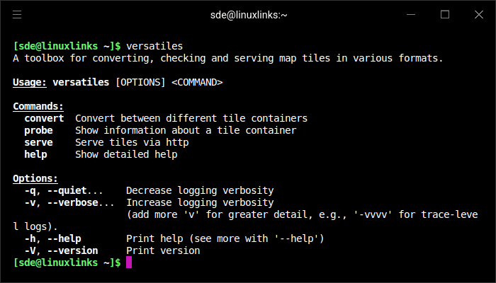
It can be used as a command-line utility for individual conversion jobs or as part of a larger self-hosted mapping stack. VersaTiles works with local and remote tile sources and can serve map data together with the assets needed by a browser-based map frontend.
This is free and open source software.
Key Features
- Reads and writes VersaTiles, PMTiles, MBTiles, tar archives and directory-based tile stores.
- Can access supported tile containers over HTTP and other remote sources as well as local files.
- Converts between tile container formats while filtering by geographic bounding box and zoom range.
- Processes raster tiles and supports commonly used image and compression formats.
- Provides a pipeline language for constructing repeatable map-data processing workflows.
- Can ingest geospatial source data including GeoJSON, newline-delimited GeoJSON, Shapefile and point data from CSV.
- Includes commands for inspecting tile containers and validating their contents.
- Runs a high-performance tile server capable of serving multiple tile sources from one configuration.
- Can serve a map frontend together with styles, fonts and symbols for MapLibre-based maps.
- Supports configuration through YAML for more complex server setups, including headers and cross-origin access settings.
- Offers downloadable map datasets including OpenStreetMap vector tiles and additional terrain-related data.
- Provides precompiled Linux binaries while also supporting builds from source with Cargo.
Website: github.com/versatiles-org/versatiles-rs
Support:
Developer: VersaTiles
License: MIT License
VersaTiles is written in Rust. Learn Rust with our recommended free books and free tutorials.
Related Software
| Mapping Tools | |
|---|---|
| Organic Maps | Offline maps & GPS app for hiking, cycling, biking, and driving |
| CoMaps | Community-led maps and navigation application |
| QGIS | GIS that supports vector, raster, and database formats |
| Marble | Virtual globe and world atlas |
| Placemark | Web-based tool for geospatial data |
| Maputnik | Visual editor for creating and editing MapLibre map styles |
| JOSM | Extensible editor for OpenStreetMap |
| uMap | Web application for creating and publishing custom interactive maps |
| Map | Wardley map editor |
| Kadas Albireo | Mapping application based on QGIS targeted at non-specialized users |
| TuiView | Lightweight raster GIS |
| Pure Maps | Native map and navigation application |
| Merkaartor | OpenStreetMap mapping program |
| GNOME Maps | Find places around the world |
| FacilMap | Collaborative map for planning and sharing locations |
| VersaTiles | Generate, process, store, serve, and render map tiles |
| osmin | GPS navigator for on-road and off-road navigation |
| OpenStreetBrowser | Browse and explore OpenStreetMap data by category |
| Maps | Lightweight map viewer for exploring places and locations |
Read our verdict in the software roundup.
 LinuxLinks helps you discover the best free and open source software for Linux. Explore our extensive collection of recommended applications, including alternatives to popular proprietary software. We also publish software reviews, Linux tutorials, hardware reviews, free programming books and articles covering the wider open source community. Browse our Linux resources to discover more. Know a useful free and open source Linux application we haven't covered? Suggest a program for inclusion. Has your software been featured on LinuxLinks? Display one of our Featured on LinuxLinks badges on your website or GitHub README. |
Please read our Comment Policy before commenting.