
Last Updated on February 27, 2026
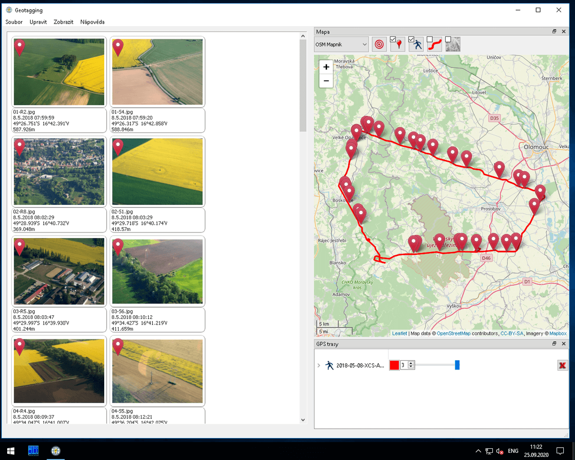
Geotagging is a simple tool for manipulating with geographical information stored in JPEG images (in EXIF section).
Your photos can be augmented by GPS coordinates by synchronization from track log files (*.gpx). The GPS coordinates can be also adjusted manually using Drag and Drop.
This is free and open source software.
Key Features
- Cross-platform support – runs under Linux and Windows.
- Internationalization support.
Website: github.com/jmlich/geotagging
Support:
Developer: Jozef Mlich
License: GNU General Public License v3.0
Geotagging is written in C++. Learn C++ with our recommended free books and free tutorials.
Related Software
| Photo Geotagging Tools | |
|---|---|
| GpsPrune | View, edit and convert coordinate data from GPS systems |
| KGeoTag | Photo geotagging written in C++/Qt |
| GPS Correlate | Correlates digital images with GPS data filling EXIF fields |
| Geotag | Match date/time information from photos |
| Geotagging | Photography geotagging tool |
| GottenGeography | Photo geotagging application for the GNOME desktop environment |
Read our verdict in the software roundup.
| GPS Tools | |
|---|---|
| MOBAC | Create offline atlases for GPS handhelds and cell phone applications |
| GPXSee | GPS log file viewer and analyzer |
| Traccar | GPS Tracking Platform |
| gpsd | GPS service daemon |
| Viking | GPS data editor, analyzer and viewer |
| GPSBabel | GPS file conversion plus transfer to/from GPS units |
| GpsPrune | View, edit, and convert coordinate data from GPS systems |
| ZombieTrackerGPS | Fitness and GPS track manager designed for KDE |
| QMapShack | GPS mapping (GeoTiff and vector) and GPSr management |
| Navit | Car navigation system with routing engine |
| GPS Correlate | Correlates digital images with GPS data filling EXIF fields |
| Open Cache Manager | Easy to use program for managing your geocaches |
| FoxtrotGPS | GPS/GIS application designed for small screens |
| Satellite | Displays GNSS information obtained from NMEA sources |
| Geotagging | Photography geotagging tool |
| AAT Activity Tracker | Tracking sportive activities, with an emphasis on cycling |
Read our verdict in the software roundup.
 Explore our comprehensive directory of recommended free and open source software. Our carefully curated collection spans every major software category. Explore our comprehensive directory of recommended free and open source software. Our carefully curated collection spans every major software category.This directory is part of our ongoing series of informative articles for Linux enthusiasts. It features hundreds of detailed reviews, along with open source alternatives to proprietary solutions from major corporations such as Google, Microsoft, Apple, Adobe, IBM, Cisco, Oracle, and Autodesk. You’ll also find interesting projects to try, hardware coverage, free programming books and tutorials, and much more. Know a useful open source Linux program that we haven’t covered yet? Let us know by completing this form. |