

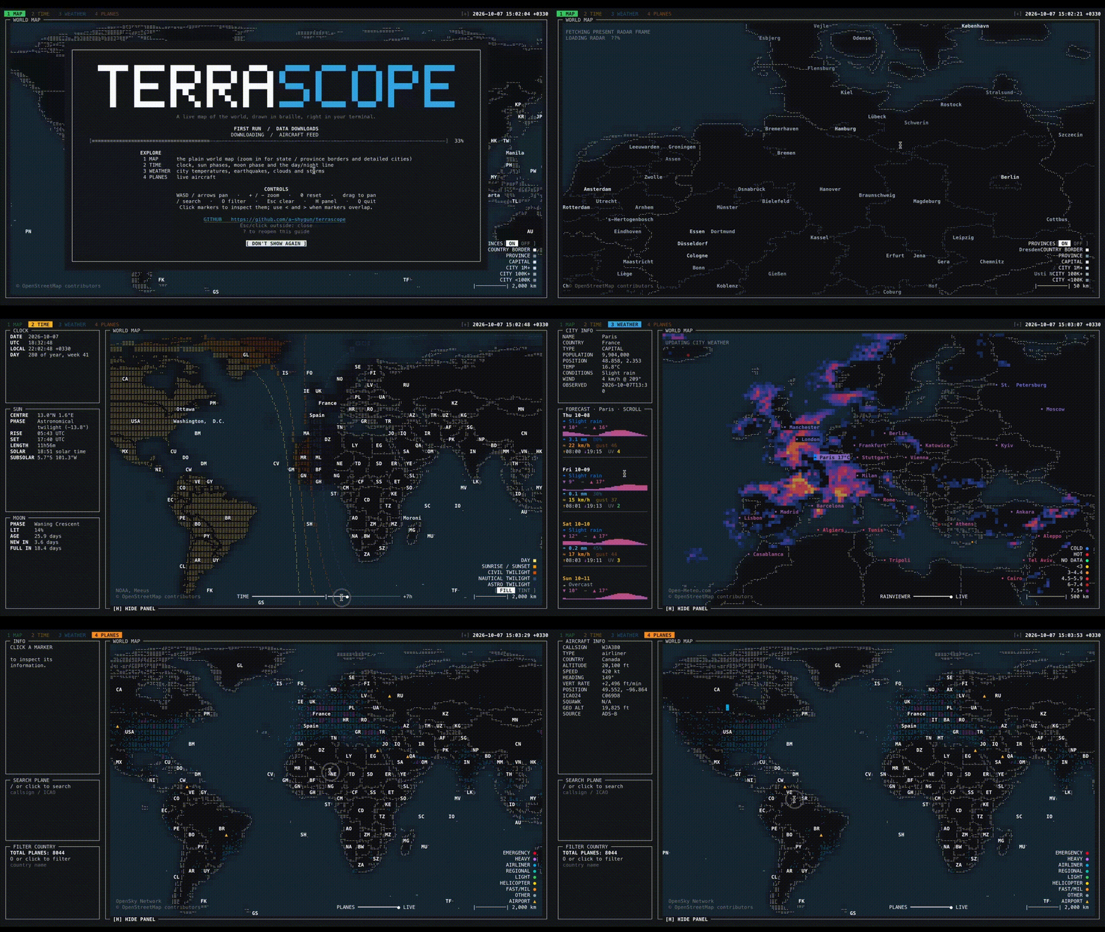
Terrascope is an interactive world map displayed directly in the terminal. It combines geographical information with environmental and aviation data, allowing users to explore locations without opening a conventional desktop mapping application. The map uses Unicode Braille characters and terminal colours to represent geographical features, with keyboard and mouse controls for navigating between locations.
The application draws on Natural Earth for geographical information and several online services for live data. It provides separate views for exploring the map, examining time information, checking weather conditions and following aircraft movements. Geographical datasets are cached locally after downloading, reducing repeated network requests. An offline mode allows users to work with previously cached information, although live data naturally requires network access.
This is free and open source software.
Key Features
- Displays country boundaries, province and state outlines, populated places and geographical labels.
- Supports keyboard and mouse panning, zooming and marker selection.
- Provides separate Map, Time, Weather and Planes views.
- Displays city weather conditions and forecasts from Open-Meteo.
- Shows temperature, precipitation, wind and sunrise/sunset information.
- Includes an animated weather radar overlay using RainViewer data.
- Displays earthquakes retrieved from USGS feeds.
- Tracks aircraft positions using OpenSky Network data.
- Shows aircraft trails, categories and airport locations.
- Provides day/night bands and alternative rendering modes.
- Displays sun and moon information with a searchable timezone selector.
- Supports searching and filtering geographical and live data.
- Allows individual map layers to be enabled or disabled.
- Offers horizontal and vertical information panels that can be hidden.
- Uses locally cached geographical datasets and previously retrieved API data.
- Includes an offline mode that disables live network requests.
- Supports configurable keyboard shortcuts, colours and map settings.
- Provides commands for inspecting and clearing cached data.
- Cross-platform support – runs on Linux and macOS.
Website: github.com/a-shygun/Terrascope
Support:
Developer: Amir Shygun
License: MIT License
Terrascope is written in Python. Learn Python with our recommended free books and free tutorials.
 LinuxLinks helps you discover the best free and open source software for Linux. Explore our extensive collection of recommended applications, including alternatives to popular proprietary software. We also publish software reviews, Linux tutorials, hardware reviews, free programming books and articles covering the wider open source community. Browse our Linux resources to discover more. Know a useful free and open source Linux application we haven't covered? Suggest a program for inclusion. Has your software been featured on LinuxLinks? Display one of our Featured on LinuxLinks badges on your website or GitHub README. |
Please read our Comment Policy before commenting.