
In Operation
TermTrack includes aliases which makes it easy to toggle different satellites. There are aliases for:
- Hubble Space Telescope (HST) – the first and flagship mission of NASA’s Great Observatories program.
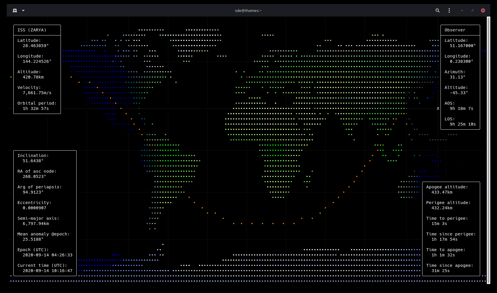
- International Space Station (ISS) – a joint project of five space agencies: the National Aeronautics and Space Administration (United States), the Russian Federal Space Agency (Russian Federation), the Japan Aerospace Exploration Agency (Japan), the Canadian Space Agency (Canada) and the European Space Agency (Europe).
- Landsat 7 – the seventh satellite of the Landsat program. Landsat 7’s primary goal is to refresh the global archive of satellite photos, providing up-to-date and cloud-free images.
- Landsat 8 – the eight satellite of the Landsat program. Landsat 8 provides moderate-resolution imagery, from 15 metres to 100 metres, of Earth’s land surface and polar regions.
- QZS-1 (Michibiki-1) – aimed at overcoming ground interference by launching more navigation satellites strategically positioned high in the sky above Asia.
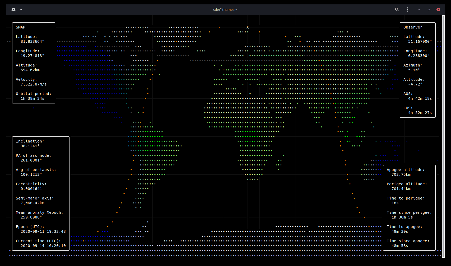
- SMAP – Earth observing satellite designed to make high resolution global observations of Earth’s vital surface soil moisture content and freeze/thaw cycle just below your feet.
Here’s an image of TermTrack showing the International Space Station. The image has been optimized to produce clear and attractive colors against a black background.
There’s various keyboard shortcuts that let you enable/disable options such as night shading, draw apoapsis and periapsis markers, show/hide latitude/longitude grid, draw a defined number of orbits ahead of the satellite, turn off the information panels, and much more.
This image shows tracking for the SMAP satellite.
But you can track a huge number of other satellites. Satellite locations are derived from TLE data downloaded from CelesTrak. The data is fed into pyephem where the current position of the satellite is computed using SGP4.
Pages in this article:
Page 1 – Introduction / Installation
Page 2 – In Operation
Page 3 – Summary