
Last Updated on July 12, 2021
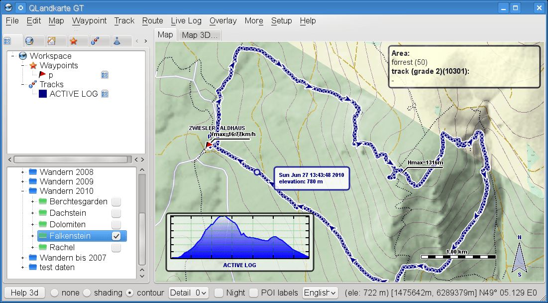
QLandkarte GT is a versatile tool for GPS maps in GeoTiff format as well as Garmin’s img vector map format. QLandkarteGT is the successor of QLandkarte. Among various improvements (e.g. 2D/3D map rendering and reduced resource requirements) the major difference is its device-independent architecture, which is not limited to Garmin devices anymore. Additionally, it is the PC-side front end to QLandkarte M, a moving map application for mobile devices.
QLandkarte GT serves as a frontend to the GDAL tools, to make georeferencing of scanned maps feasible for users. In contrast to similar tools (e.g. QGis) its straightforward interface is especially suited for non-scientific users.
This software is no longer in development.
Features include:
- Import collection of GeoTiff files.
- Import Garmin maps (needs *tdb).
- Import Garmin BirdsEye (*.jnx).
- OSM Tile Server access built-in.
- Load single raster map files supported by GDAL.
- Convert raw bitmaps into GeoTiff.
- Export sub-area from raster map as GeoTiff.
- Export sub-area from raster map as KMZ.
- Export sub-area from raster map as Garmin Custom Map.
- Zooming / moving.
- Relief shading.
- OpenGL 3D map view.
- Print map.
- Skinning for Garmin maps (*typ file).
- Export sub-area from GeoTiff.
- Zooming / moving.
- Relief shading.
- Search Google maps.
- Search for symbols on raster map.
- Create, edit, delete, and move waypoints.
- Edit waypoint.
- Delete waypoint.
- Move waypoint.
- Exchange waypoints with QLandkarte M.
- Built-in diary editor.
- Save / load wayoints as GPX.
- Save / Load waypoints as QLandkarte binary.
- Show tracks on map.
- Purge / delete trackpoints.
- Edit track properties.
- Save / load tracks as GPX.
- Save / load tracks as QLandkarte binary.
- Tour planning:
- Draw your own tour.
- Snap to streets on vector maps.
- Copy and paste fragments from other tours.
- Join several tours into one.
- Support for NMEA and GPSD.
- Internationalization support: English, German, French, Russian, Spanish and Dutch languages.
Website: www.qlandkarte.org
Support:
Developer: Oliver Eichler and contributors
License: GNU GPL v2
| Explore Linux | |
|---|---|
 | Best Free and Open Source Software - A huge collection of recommended free and open source software covering every major category. |
 | In-depth Linux Software Reviews - Detailed assessments of Linux software covering features, usability and overall quality. |
 | The Big List of Active Linux Distros - An extensive collection of actively developed Linux distributions. |
 | Open Source Alternatives - Alternatives to software and services from Google, Microsoft, Apple, Adobe, IBM, Autodesk, Oracle and others. |
 | Essential Linux System Tools - Indispensable utilities for monitoring, maintaining and managing Linux systems. |
 | Linux Productivity Tools - Useful utilities for improving productivity and streamlining everyday tasks. |
 | Alternatives to Popular CLI Tools - Modern alternatives to familiar command-line utilities supplied with Linux systems. |
 | Awesome Free Linux Game Tools - Tools, utilities and companion software that improve gaming on Linux. |
 | Machine Learning on Linux - Machine learning and deep learning software, self-hosted applications and practical tools. |
 | Saving Money with Linux - Practical ways to reduce electricity consumption and lower computing costs with Linux. |
 | Linux Candy - Fun, entertaining and sometimes delightfully quirky software from the lighter side of Linux. |
Please read our Comment Policy before commenting.