ncview is software to get a quick and easy viewer for NetCDF files. View simple movies of the data, view along various dimensions.
Read more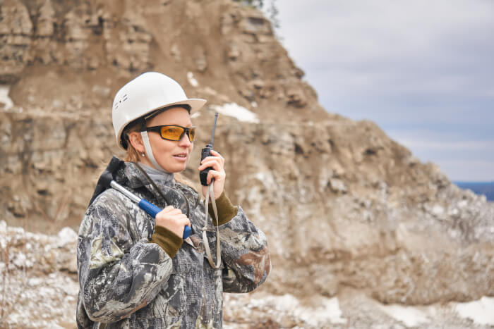
The Linux Portal Site
ncview is software to get a quick and easy viewer for NetCDF files. View simple movies of the data, view along various dimensions.
Read more
GrADS is an interactive desktop tool that is used for easy access, manipulation, and visualization of earth science data.
Read more
Therion is a tool for cave surveying. This application archive survey data on computer in a form as close to the original notes and sketches.
Read more
Survex is free and open source software suite to process, view, and print cave survey data. This is cross-platform software.
Read more
GMT is a collection of tools that allow users to manipulate (x,y) and (x,y,z) data sets (including filtering, trend fitting, gridding.
Read more
Geographic Resources Analysis Support System (GRASS) is an open source GIS used for geospatial data management and analysis.
Read more
User-Friendly Desktop Internet GIS (uDig) is a spatial data viewer/editor, with special emphasis on the OpenGIS standards for internet GIS.
Read more
Quantum GIS (QGIS) is a user friendly Open Source Geographic Information System (GIS). QGIS supports vector, raster, and database formats.
Read more
PostGIS is a spatial database extender for PostgreSQL object-relational database. It adds support for geographic objects.
Read more
GPlates offers interactive plate-tectonic reconstructions, geographic information system functionality and raster data visualization.
Read more