
SaVi is software written to facilitate the visualization and analysis of satellite constellations.
SaVi simulates satellite orbits and coverage, in two and three dimensions. SaVi lets you explore satellite constellations.
SaVi can be run either as a stand-alone program, or as an “external module” for the Geomview program. The latter mode enables three-dimensional visualization of the satellite constellations, but also requires Geomview.
This is free and open source software.
Key Features
- Constellations menu allows you to load in simulations of known satellite constellations, both existing and proposed.
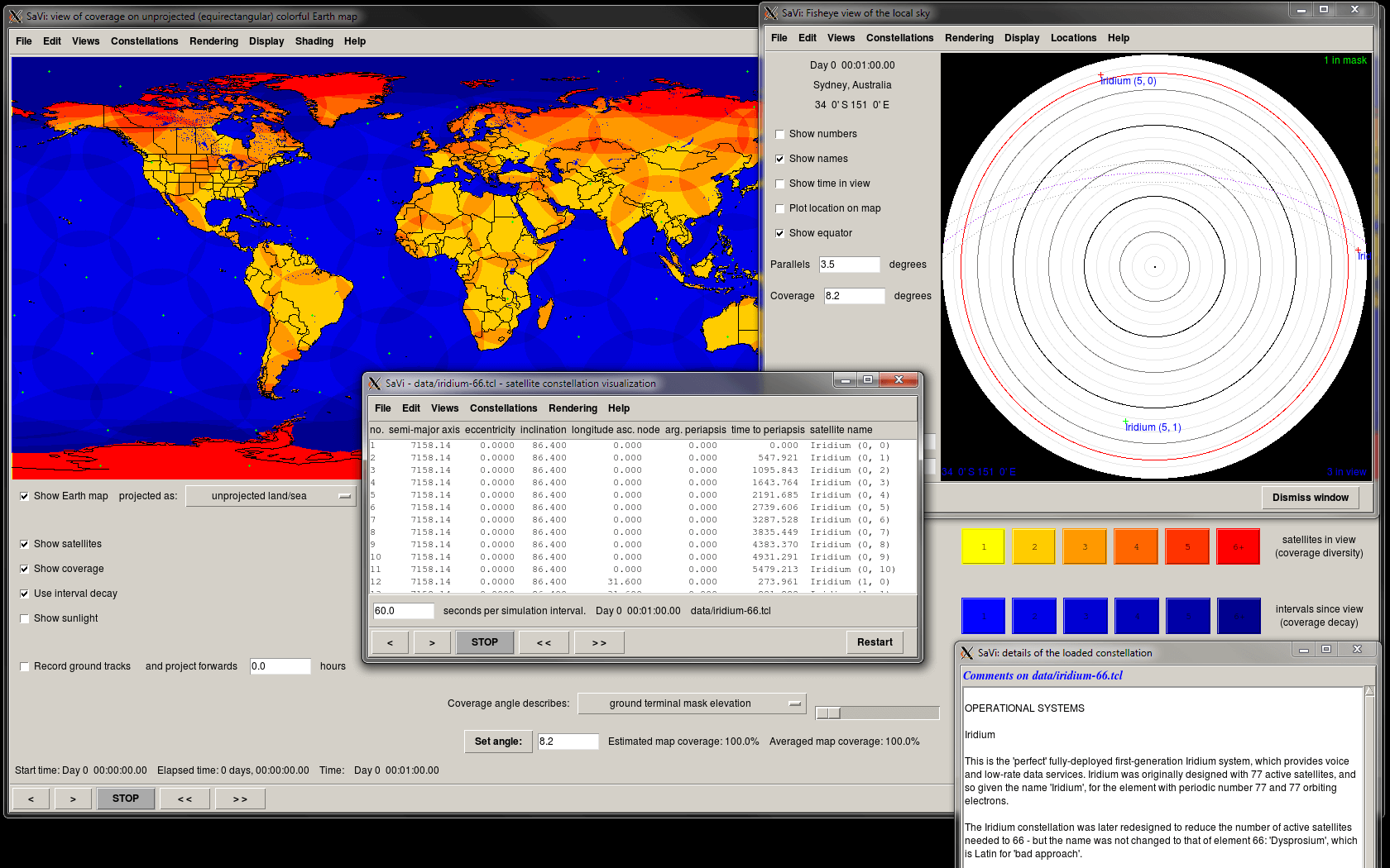
- Coverage panel – a map projection of the Earth and visible coverage is shown.
- Fisheye window shows a view of the sky looking upwards from the ground, with the horizon around the outside of the circle.
- Can use Geomview or 3D rendering of Earth and satellites. Supports 3D texturemapping of the Earth sphere to Geomview, if OpenGL is supported.
- Can use gifsicle for saving animations of satellite coverage.
- Cross-platform support – runs under Linux, macOS, and Windows.
Website: savi.sourceforge.io
Support:
Developer: Lloyd Wood
License: Open source
SaVi is written in C. Learn C with our recommended free books and free tutorials.
Related Software
| Satellite Tools | |
|---|---|
| Gpredict | Real-time satellite tracking and orbit prediction application |
| GNSS-SDR | Software-defined receiver for Global Navigation Satellite System signals |
| SatDump | Generic satellite data processing software |
| PreviSat | Satellite tracking software for observing purposes |
| SaVi | Simulates satellite orbits and coverage, in two and three dimensions |
| tracker | Real-time satellite tracks and orbit prediction |
| TLEscope | Satellite visualization tool |
| strf | Satellite tracking toolkit for radio observations |
| Satellite | Displays GNSS information obtained from NMEA sources |
| Ground Station | Satellite monitoring and radio communication suite |
| TermTrack | Track satellites in your terminal |
| OrbVis | View and propagate the full CelesTrak satellite catalog in realtime |
| Flyby | Tracks and predicts passes of satellites in Earth orbit |
| SatIntel | OSINT tool for satellite reconnaissance |
Read our verdict in the software roundup.
 Explore our comprehensive directory of recommended free and open source software. Our carefully curated collection spans every major software category. Explore our comprehensive directory of recommended free and open source software. Our carefully curated collection spans every major software category.This directory is part of our ongoing series of informative articles for Linux enthusiasts. It features hundreds of detailed reviews, along with open source alternatives to proprietary solutions from major corporations such as Google, Microsoft, Apple, Adobe, IBM, Cisco, Oracle, and Autodesk. You’ll also find interesting projects to try, hardware coverage, free programming books and tutorials, and much more. Discovered a useful open source Linux program that we haven’t covered yet? Let us know by completing this form. |