

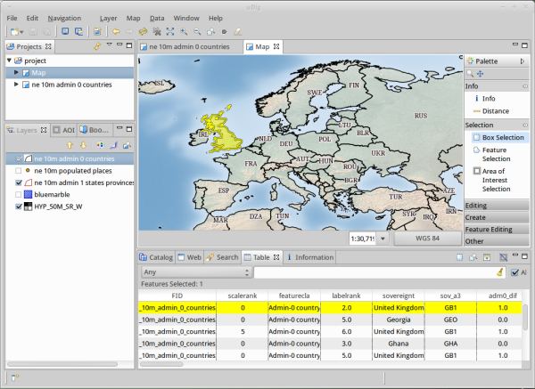
User-Friendly Desktop Internet GIS (uDig) is an open source spatial data viewer/editor, with special emphasis on the OpenGIS standards for internet GIS, the Web Map Server and Web Feature Server standards.
uDig aims to be:
- User friendly – providing a familiar graphical environment for GIS users.
- Desktop located – thick client.
- Internet oriented – WMS, WFS, WCS, GeoRSS, KML, tiles geospatial web services.
- GIS ready – providing the framework on which complex analytical capabilities can be built, and gradually subsuming those capabilities into the main application.
It is a Java based open source desktop application framework, built with Eclipse Rich Client (RCP) technology.
Key Features
- An out-of-the-box application, with the ability to view, edit and print files, database (Oracle, SDE, PostGIS) and Web Feature Servers (WFS).
- An industry-standard extension framework (RCP) for adding new functionality to the application.
- A rich toolkit of Java functionality, ready for developers to build on.
- Uses GRASS for complex vector operations.
- PostGIS.
- WMS.
- Desktop Client with Drag and Drop integration for File explorer and Web Browser.
- Integrate with your existing infrastructure: ArcSDE, Oracle, DB2 and more.
- Work with local files: Shapefile, jpeg, png, tiff and more.
- Work with advanced spatial raster formats: ECW, MrSID, JPEG 2000.
- Support for compliant Web Map Servers (GeoServer, MapServer tested).
- Integrated Web experience with an embedded browser that recognises OGC web services and smoothly adds links to the onscreen map.
- Style Layer Descriptor control of rendering allowing you to publish your Map using the same settings in uDig as with popular Web Map Servers.
- Deep integration of standards allowing the application to swap between the appropriate service as required for display, interaction and editing.
- Printing and PDF Generation.
- Native support for many other data sources.
- Cross-platform support – runs on Linux, Mac OS X, and Windows.
Website: udig.refractions.net
Support: Documentation
Developer: Refractions Research
License: Dual BSD / EPL (Eclipse Foundation)
uDig is written in Java. Learn Java with our recommended free books and free tutorials.
Related Software
| GIS: Earth Science Software | |
|---|---|
| GRASS | Geographic Resources Analysis Support System |
| Quantum GIS | User friendly Geographic Information System |
| SAGA | System for Automated Geoscientific Analyses |
| GMT | Collection of tools that allow users to manipulate data sets |
| GeoServer | Server written in Java that allows users to share and edit geospatial data |
| OpenJUMP | Geographic Information System written in Java |
| gvSIG Desktop | Powerful, user-friendly Geographic Information System |
| PostGIS | Database extender for PostgreSQL object-relational database |
| WhiteboxTools | Advanced geospatial data analysis platform |
| MapServer | System for developing web-based GIS applications |
| uDig | Spatial data viewer/editor |
Read our verdict in the software roundup.
 LinuxLinks helps you discover the best free and open source software for Linux. Explore our extensive collection of recommended applications, including alternatives to popular proprietary software. We also publish software reviews, Linux tutorials, hardware reviews, free programming books and articles covering the wider open source community. Browse our Linux resources to discover more. Know a useful free and open source Linux application we haven't covered? Suggest a program for inclusion. Has your software been featured on LinuxLinks? Display one of our Featured on LinuxLinks badges on your website or GitHub README. |
Please read our Comment Policy before commenting.