Last Updated on August 11, 2021
In Operation
asciiworld comes supplied with a map of the world.
The project comes with some additional tools offering geoIP, satellite tracking, and different world projections.
asciiworld has a variety of command-line flags that offer various functionality. The images below show some of the options that are available.
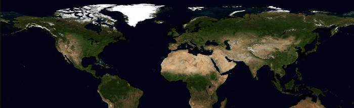
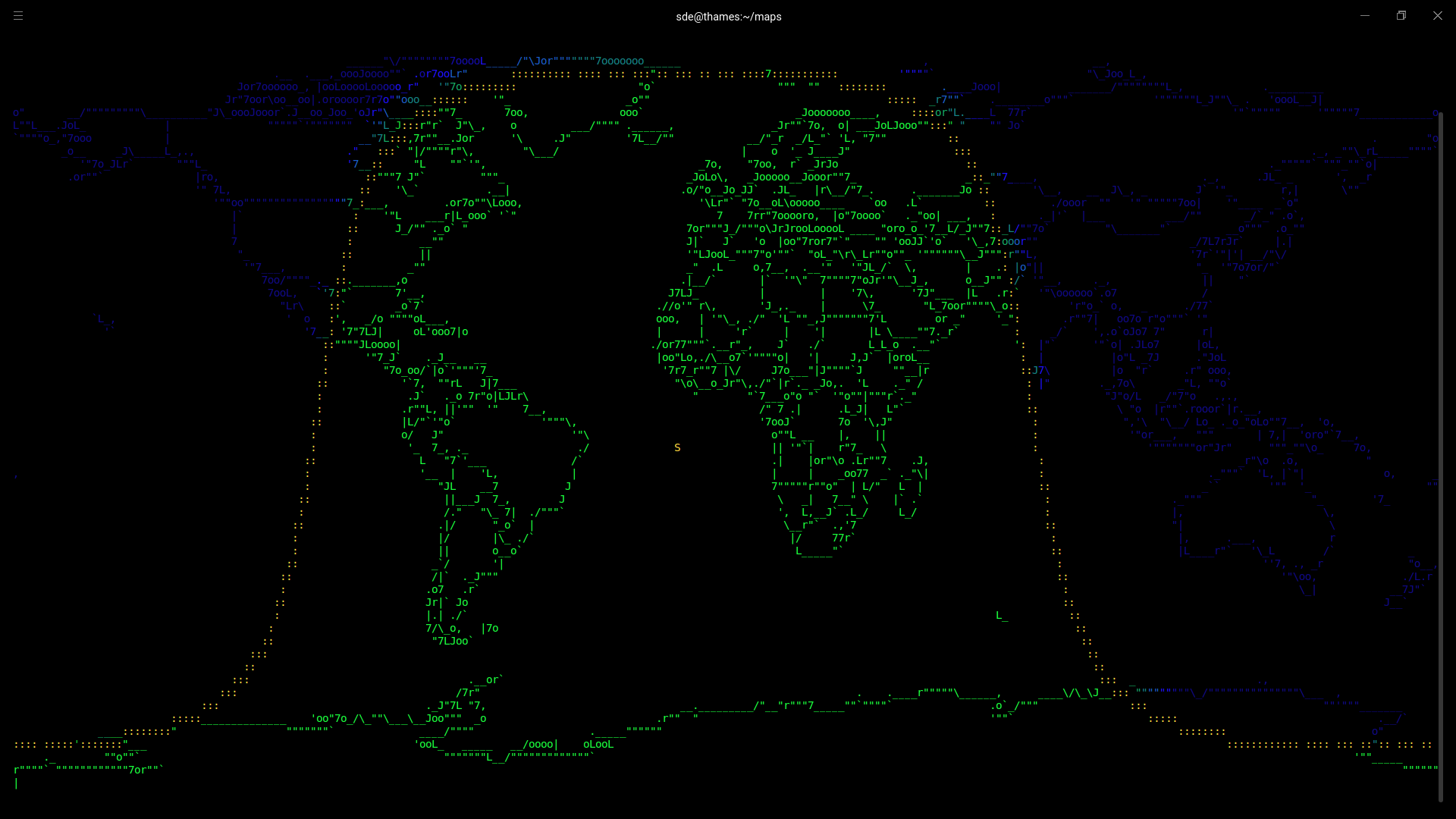
Map (with no flags)
$ asciiworld
Here’s an image of the pre-bundled world map rendered with ASCII characters.
You’ll get a better representation of each image by clicking each image to see it full size.
We cannot fail to notice that some countries (particularly the UK) seem to come out rather badly in their representation. But overall, the map is rendered rather well.
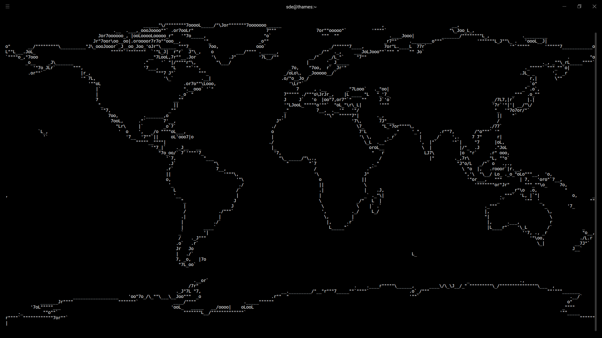
Map (with day-and-night mode)
$ asciiworld -s
With the -s flag, the program displays the map showing the parts of the world that are currently in sunlight and the area currently in darkness.
In the image, you’ll see an S character in the middle of the Atlantic ocean. The S marks the position of the sun.
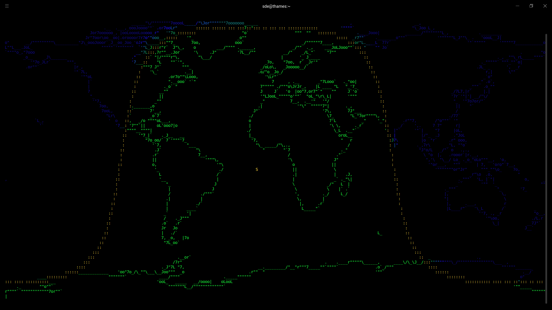
Map (solid fill)
$ asciiworld -s -o
Let’s enhance the world map a bit more.
In the image to the left, we can see the world map with land masses as filled polygons.
There’s a few other options available. For example, you can change the definition of dusk, and choose a different projection. Besides the default equirectanguar projection, there also Kavrayskiy VII, Lambert cylindrical equal-area, and Hammer map projection.
The Kavrayskiy VII was invented by Soviet cartographer Vladimir V. Kavrayskiy in 1939 for use as a general-purpose pseudocylindrical projection. It’s designed to produce good-quality maps with low distortion overall.
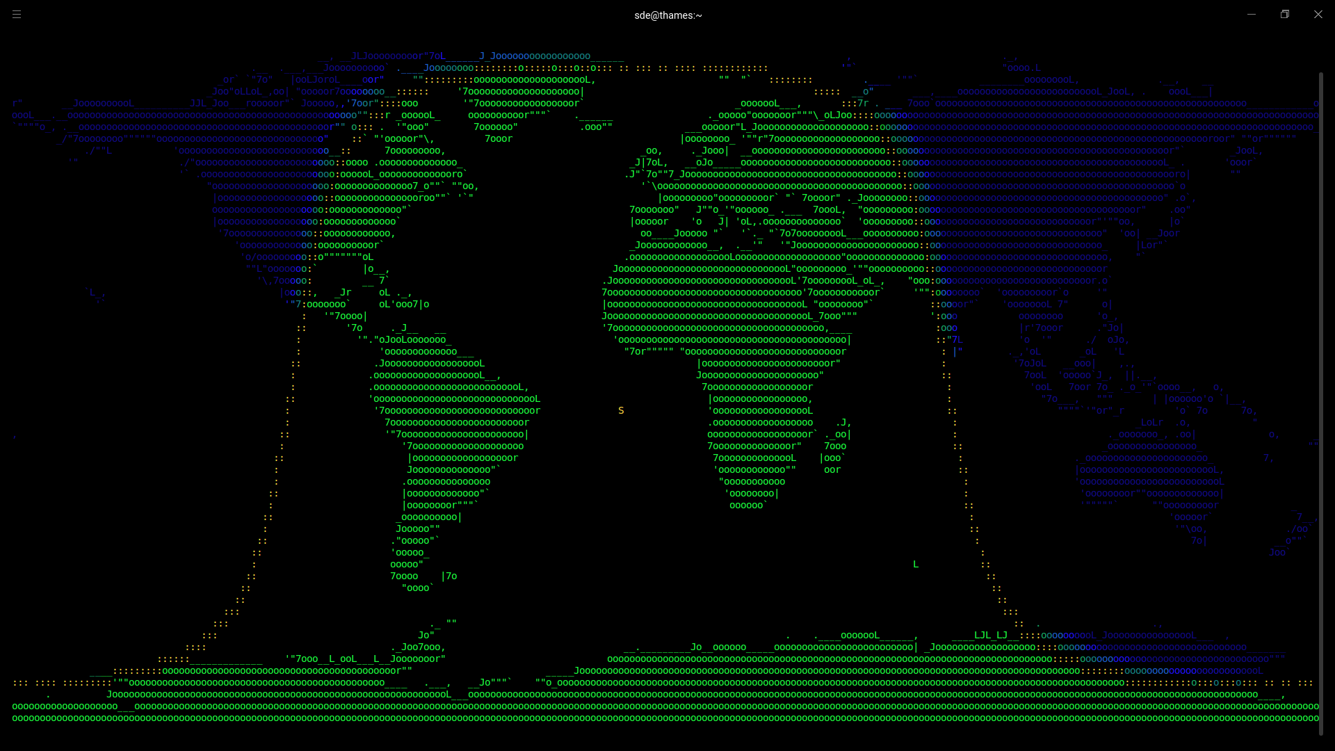
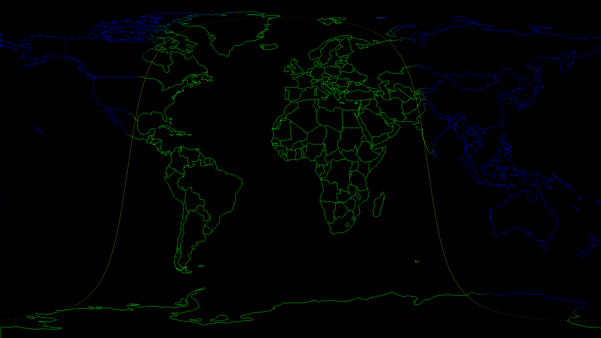
Map showing countries
$ asciiworld -s -m ne_110m_admin_0_countries.shp
We’ve not limited to the bundled map. The software can read ESRI Shapefiles.
In the image to the right, we’re using asciiworld to display a map showing country borders.
The shapefile format stores the data as primitive geometric shapes like points, lines, and polygons. These shapes, together with data attributes that are linked to each shape, create the representation of the geographic data.
Generate an image of the world map (PNG file)
$ asciiworld -w 1920 -h 1080 -s -m ne_110m_admin_0_countries.shp -W asciiworld-countries.png
This image isn’t an ASCII representation, but it is generated by asciiworld.
The map shows the day and night zones, together with countries detailed on the land masses. And it’s a generated PNG file.
The -w and -h flags enable us to force the output size. Here we’ve chosen the output to be 1920×1080.
Pages in this article:
Page 1 – Introduction / Installation
Page 2 – In Operation
Page 3 – Summary
The first command may is: “git clone https://www.uninformativ.de/git/asciiworld.git“.
Typo corrected, thanks.