

GottenGeography is a geotagging application written for the GNOME desktop.
It stores geographical information directly into your photos’ EXIF data, so you never forget where your photos were taken.
This is free and open source software.
Key Features
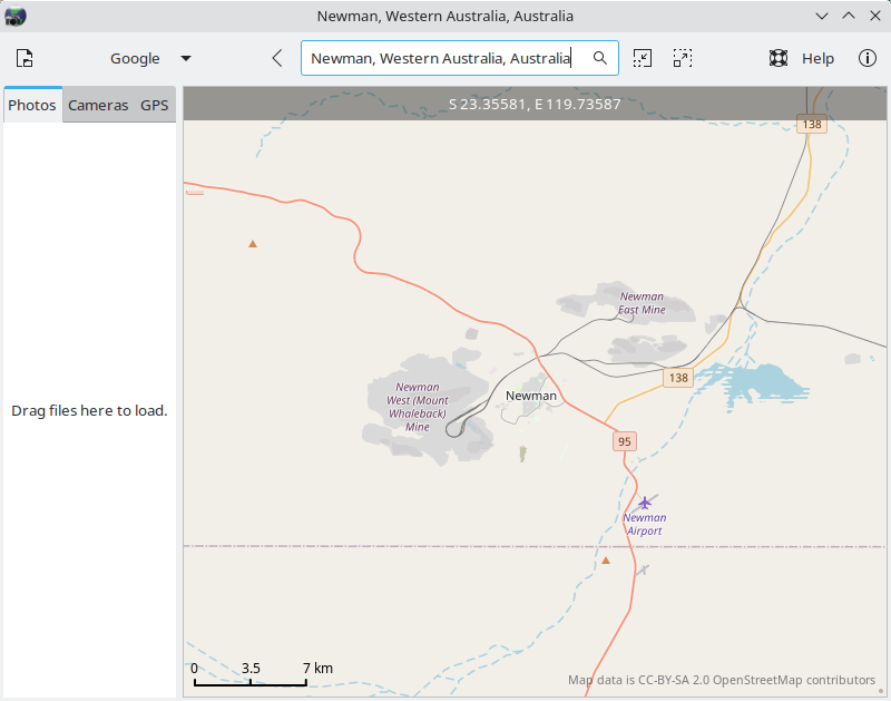
- Display maps using libchamplain and OpenStreetMap.
- Parse GPX/KML (xml) files and display the GPS tracks on the map, using expat.
- Read pre-existing geotags inside photo EXIF data using pyexiv2 and display markers on the map indicating where those photos were taken.
- Manually geotag images, using either of two methods: by clicking the ‘apply’ button, the selected photos are placed onto the center of the map, or by drag & drop.
- Automatically geotag images using timestamp comparison between photos and GPX data, proportionally calculating photo coordinates that fall in-between gpx track points.
- Reverse geocode using a db dump of GeoNames.org geolocation data. Stores city, province/state, and country names in IPTC data automatically.
- Automatically determine the timezone that your photos were taken in so that you don’t have to specify it manually when you go travelling.
- Extensive use of GSettings to store program state, meaning that each time you launch GottenGeography, it remembers things like where on the map you were last browsing, what map you were using, what size the window was, etc.
- Save EXIF/IPTC data into your photos using pyexiv2.
Website: github.com/marcoil/gottengeography
Support:
Developer: Marc Ordinas i Llopis
License: GNU General Public License v3.0
GottenGeography is written in Python. Learn Python with our recommended free books and free tutorials.
Related Software
| Photo Geotagging Tools | |
|---|---|
| Photini | Digital photograph metadata editing application |
| GpsPrune | View, edit and convert coordinate data from GPS systems |
| KGeoTag | Photo geotagging written in C++/Qt |
| GPS Correlate | Correlates digital images with GPS data filling EXIF fields |
| Geotag | Match date/time information from photos |
| Geotagging | Photography geotagging tool |
| GottenGeography | Photo geotagging application for the GNOME desktop environment |
Read our verdict in the software roundup.
 Explore our carefully curated directory of recommended free and open source software, covering every major software category. Explore our carefully curated directory of recommended free and open source software, covering every major software category.The directory forms part of our extensive collection of articles for Linux enthusiasts. It includes hundreds of detailed reviews, together with free and open source alternatives to proprietary software from companies such as Google, Microsoft, Apple, Adobe, IBM, Cisco, Oracle, and Autodesk. LinuxLinks also covers interesting projects worth exploring, Linux-compatible hardware, free programming books and tutorials, and much more. Know a useful free and open source Linux application that we haven’t covered? Tell us about it using our submission form. |
Please read our Comment Policy before commenting.